
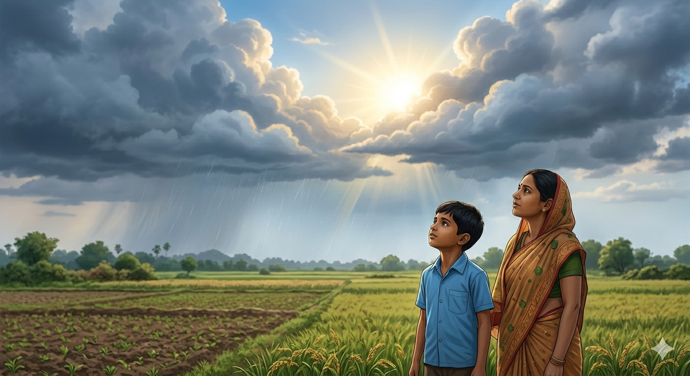
“Your elders can predict rain by watching the sky, animals and plants — without any instruments. Scientists use special tools to measure the same thing. Which method do you think is more accurate — and why?”
— Think about this as you read Chapter 2🎯 Learning Objectives — After this chapter you will be able to:
- Define weather and name its elements
- Explain how people predict weather using natural signs
- Name and describe six weather instruments and what they measure
- Understand temperature, rainfall, atmospheric pressure, wind and humidity
- Describe the India Meteorological Department and its importance
- Explain how weather predictions help people in daily life
Weather is the condition of the atmosphere at a particular place at a particular time. It changes from day to day and even from hour to hour. When you look outside in the morning and decide whether to carry an umbrella — you are thinking about weather.
Weather has several elements that together describe what the atmosphere is like at any given time. These elements are temperature (how hot or cold it is), humidity (how much water vapour is in the air), rainfall (how much rain has fallen), wind (the movement of air), atmospheric pressure (the weight of air pressing down) and cloud cover (how much of the sky is covered by clouds).
Weather changes from day to day and place to place. The words we use to describe weather — hot, cold, warm, chilly, pleasant, rainy — are all describing one or more elements of weather. In Hindi we say “bahut zyada garmi” for hot weather, “thand” for cold, “baarish” for rainy and “suhaavana mausam” for pleasant weather.
📝 Questions — Concept 1: What is Weather?
What is weather? Name any four elements of weather.
How does weather affect your daily life? Give three examples from your own experience.
Weather changes from hour to hour while climate describes long-term patterns. Why do you think it is important to understand the difference between weather and climate? Give an example to explain.
Different regions of India experience very different weather on the same day — one part may be having a heatwave while another has floods. What does this tell us about India’s geographical diversity?
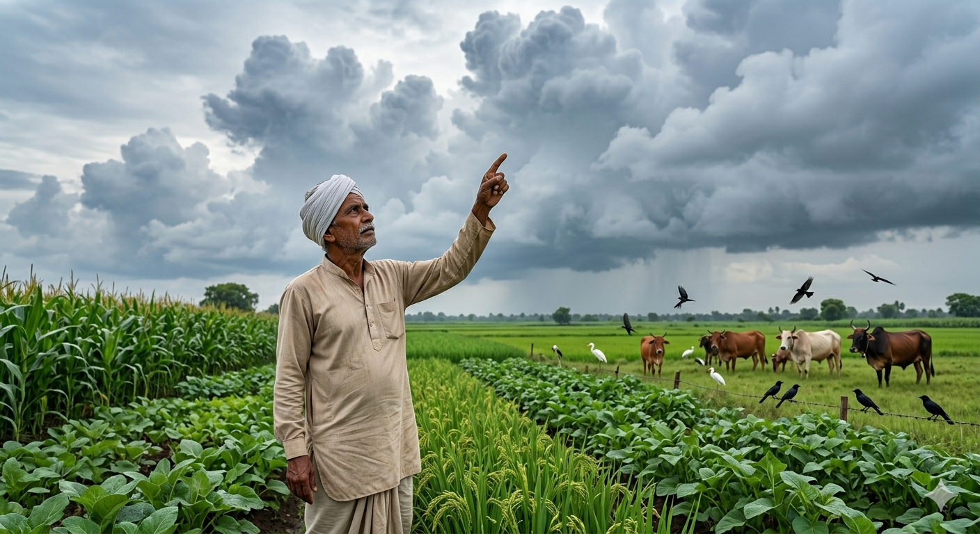
Before modern instruments were invented, people predicted weather by carefully observing nature. Farmers, fishermen and sailors developed this knowledge over many generations. They observed cloud patterns, wind direction, animal behaviour and plant signs to predict rain, storms or drought.
For example, when certain birds fly low, it often signals incoming rain. When cats wash behind their ears, some believe rain is coming. When leaves of some plants turn upward, it indicates moisture in the air. Ants carrying their eggs to higher ground indicates flooding. These are traditional weather signals developed over centuries of careful observation.
Talk to elders in your neighbourhood and ask them how they predict the weather. What signs do they observe? Document any sayings in your regional language that refer to weather prediction. For example, elders often say “when the peacock dances, rain is near” or “red sky at night, sailor’s delight.”
📝 Questions — Concept 2: Natural Weather Forecasting
Name any three natural signs that people use to predict rain without instruments.
How did farmers and fishermen develop the ability to predict weather without modern instruments? Explain the process in your own words.
Traditional weather prediction methods have been used for thousands of years. Do you think they are still relevant today when we have satellites and modern instruments? Give reasons for your answer.
A fisherman in Kerala who can read natural signs and a meteorologist with modern instruments both try to predict tomorrow’s weather. What are the advantages and disadvantages of each approach?
We can measure and monitor the weather around us using special tools called weather instruments. Each instrument measures a specific element of weather accurately and scientifically. Using these instruments, meteorologists — scientists who study weather — can make accurate predictions that help millions of people.
| Instrument | What It Measures |
|---|---|
| 🌡️ Thermometer | Temperature (how hot or cold the air is) |
| 🌧️ Rain Gauge | Amount of rainfall |
| ⚖️ Barometer | Atmospheric pressure |
| 🌬️ Wind Vane | Direction of the wind |
| 💨 Anemometer | Speed of the wind |
| 💧 Hygrometer | Humidity (water vapour in the air) |
Remember the six weather instruments with this simple trick: T-R-B-W-A-H — Thermometer, Rain gauge, Barometer, Wind vane, Anemometer, Hygrometer. Each measures a different element of weather and together they give meteorologists a complete picture of atmospheric conditions.
📝 Questions — Concept 3: Weather Instruments
Match the instrument with what it measures: Thermometer, Rain gauge, Barometer, Wind vane, Anemometer, Hygrometer.
Why do we need six different instruments to study weather? Can one instrument measure everything? Explain your reasoning.
A small village in a remote area has no weather instruments. Which ONE instrument would you recommend they get first to help the farming community — and why?
Weather instruments need to be placed carefully to give accurate readings. Why should a thermometer be kept in shade? Why should a rain gauge be kept in an open area? What does this tell us about how measurement conditions affect accuracy?
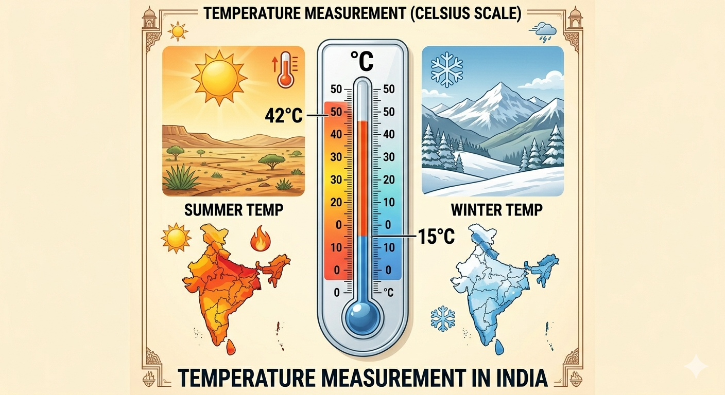
Temperature is one of the most important elements of weather. It tells us how hot or cold the air is at a particular place and time. Temperature is measured using a thermometer in degrees Celsius (°C). The thermometer is usually kept in the shade so that direct sunlight does not give a falsely high reading.
Meteorologists record both the maximum temperature (highest reading during the day) and the minimum temperature (lowest reading, usually early morning). The difference between these two is called the temperature range. Temperature range = Maximum temperature − Minimum temperature. For example, if maximum is 32°C and minimum is 14°C, then temperature range = 32 − 14 = 18°C.
What feels cold or warm is relative — it depends on what you are used to. Krishnan from Chennai said it felt cold at 20°C. But Amir from Kashmir, where temperatures reach -10°C, would find 20°C quite pleasant! This shows that human perception of temperature depends on the climate one is accustomed to — which is why we need instruments to measure temperature objectively.
📝 Questions — Concept 4: Temperature
What instrument measures temperature? What is the unit of measurement? Calculate: if maximum temperature is 38°C and minimum is 20°C, what is the temperature range?
Why is a thermometer kept in the shade when measuring air temperature? What would happen to the reading if it were kept in direct sunlight?
Krishnan feels cold at 20°C but Amir from Kashmir finds it pleasant. What does this tell us about how geography and climate shape human perception? Can you think of similar examples from your own experience?
India experiences temperatures ranging from -40°C in Leh to 50°C in Rajasthan. How does this extreme temperature range affect the way people live, dress, build houses and grow food in different parts of India?
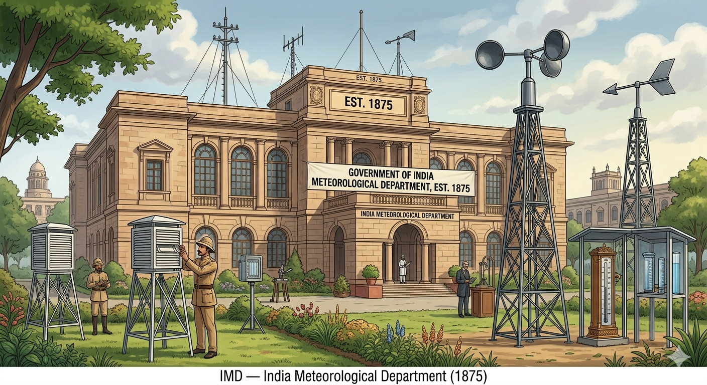
The India Meteorological Department (IMD) was established in 1875 — making it one of the oldest meteorological organisations in the world. IMD collects weather data from hundreds of weather stations across India and uses satellites, radar and computer models to forecast weather accurately.
The motto of IMD is “ādityāt jāyate vriṣhti” which comes from the ancient text Manusmriti and means “From the sun arises rain.” The complete sentence reads: “From the sun arises rain, from rain comes food, and from food, living beings originate.” This ancient wisdom perfectly captures the water cycle — the sun’s heat causes evaporation, which forms clouds, which bring rain.
Why does rain arise from the sun? The sun’s heat causes water to evaporate from rivers, lakes and oceans. These water vapours rise into the sky, cool and form clouds. When clouds become heavy with water droplets, they release rain. This is the water cycle — and the ancient authors of Manusmriti understood this process thousands of years ago!
📝 Questions — Concept 5: India Meteorological Department
When was the India Meteorological Department set up? What is its motto and what does it mean?
How does the IMD motto “From the sun arises rain” connect to the water cycle? Explain the process step by step.
IMD was established in 1875 during British rule in India. Why do you think the British colonial government set up a weather department in India? Think about agriculture, trade, military operations and sea travel.
The ancient text Manusmriti described the water cycle through the phrase “From the sun arises rain.” What does this tell us about the level of scientific observation in ancient India? Can traditional knowledge and modern science work together?
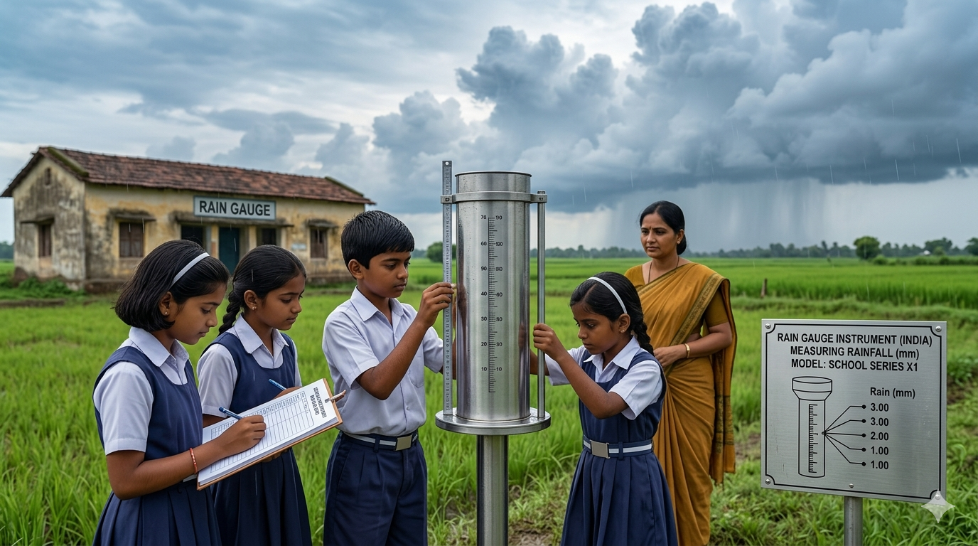
Rainfall is measured using a rain gauge. A rain gauge is a simple instrument — it is a cylindrical container that collects rainwater. A measuring scale shows how much rainfall has been collected in millimetres. Meteorologists record rainfall at the same time every day to maintain accurate and comparable data.
When placing a rain gauge, it is important to choose the correct location. The best site is an open ground on a flat surface, away from trees, walls and buildings that might block or divert rain. The gauge should be on a stable surface so it does not tilt or topple in wind. If there is snow, it must be allowed to melt before measuring.
You can make your own rain gauge! Take a clear plastic bottle and cut the top portion. Invert the top into the bottom portion as a funnel. Mark measuring lines with a ruler and waterproof marker. Place it in an open area away from trees. Record the rainfall every day at the same time for a month and calculate the weekly average. How much variation is there from week to week?
📝 Questions — Concept 6: Rainfall and Rain Gauge
What instrument is used to measure rainfall? In what unit is rainfall measured? Where should a rain gauge be placed?
A student placed a rain gauge under a large tree. Why would this give incorrect readings? Where should the rain gauge have been placed and why?
India receives most of its annual rainfall during the monsoon season (June to September). How does knowing the exact amount of rainfall help farmers, governments and city planners prepare for both floods and droughts?
Cherrapunji in Meghalaya receives over 11,000 mm of rainfall per year while Jaisalmer in Rajasthan receives less than 100 mm. How does this extreme difference in rainfall shape the lifestyle, agriculture and culture of people in these two places?
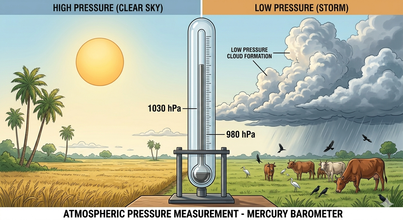
Atmospheric pressure is the weight of the air pressing down on the Earth’s surface. Though we cannot feel it, air has weight — and the column of air above us is constantly pressing down. Atmospheric pressure is measured using a barometer.
Low atmospheric pressure often signals poor weather conditions or storms. High atmospheric pressure typically indicates clear skies and calm weather. This is why meteorologists carefully track pressure changes — a sudden drop in pressure is an early warning sign of an approaching storm. Mountaineers use barometers to monitor altitude changes, and mariners use them to avoid storms at sea.
Why is it important to measure atmospheric pressure? Meteorologists use pressure data to forecast weather. Aviation professionals use it to plan safe flight paths. Mariners use it to avoid storms. Mountaineers use it to prevent altitude sickness. Scientists study it to understand climate trends. Pressure measurement is essential for the safety of millions of people every day.
📝 Questions — Concept 7: Atmospheric Pressure
What is atmospheric pressure? Which instrument measures it? What does low atmospheric pressure indicate?
Why do mountaineers carry barometers when climbing high peaks? How does atmospheric pressure change with altitude?
A sudden and significant drop in atmospheric pressure is recorded at a coastal weather station. What action should the IMD take and why? Who are the people most affected by this information?
Atmospheric pressure, though invisible, affects our daily safety. Give three examples of how changes in atmospheric pressure — if not monitored — could lead to dangerous situations for people.
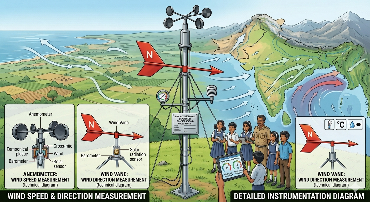
Wind is the horizontal movement of air from one place to another. Wind is caused by differences in atmospheric pressure — air moves from areas of high pressure to areas of low pressure. Wind has two important properties — direction and speed.
Wind direction is measured using a wind vane. It rotates to point in the direction from which the wind is blowing. Wind speed is measured using an anemometer, which has rotating cups that spin faster as wind blows harder. Wind plays a crucial role in distributing heat, moisture and seeds across the Earth’s surface.
Have you seen seeds flying in the wind? Wind helps seeds travel to far-off places to grow — this is called wind dispersal. Plants like dandelion, cotton and maple have specially designed seeds that catch the wind. Without wind, these seeds would fall directly below the parent plant and compete for the same resources. Wind dispersal helps plants colonise new areas and increases biodiversity.
📝 Questions — Concept 8: Wind
What is wind? Name the two instruments used to measure wind. What does each measure?
What would happen to plants if there was no wind? How does wind help in seed dispersal and plant diversity?
Wind moves from high pressure to low pressure areas. India experiences the southwest monsoon winds that bring rain from the ocean every year. How does this movement of wind across the ocean explain why the monsoon brings moisture to India?
Strong winds can be both helpful and harmful. Give two examples of how strong winds are helpful and two examples of how they cause damage. What does this tell us about the dual nature of natural forces?
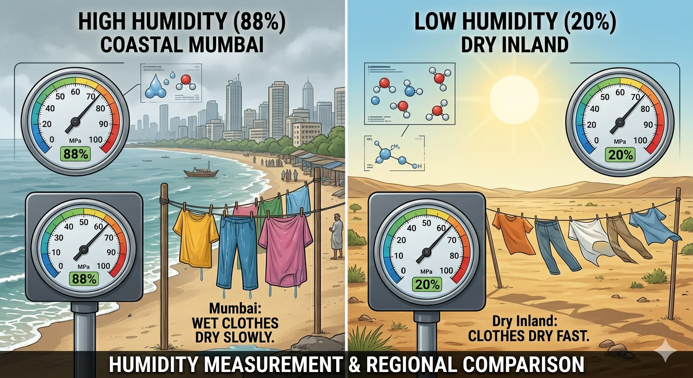
Humidity is the amount of water vapour present in the air. It is measured using a hygrometer. Humidity is usually expressed as relative humidity — a percentage showing how much water vapour the air contains compared to the maximum it can hold at that temperature.
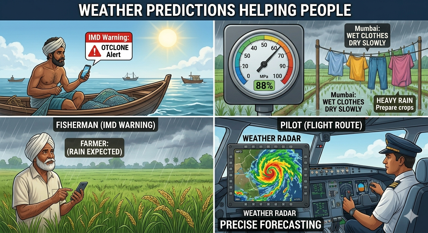
High humidity makes the air feel sticky and uncomfortable. It also makes wet clothes dry slowly because the air is already saturated with moisture. Coastal cities like Kochi and Mumbai have high humidity because they are near the sea. Desert cities like Jaipur have low humidity. High humidity is also important in many industries — certain manufacturing processes like making textiles require controlled humidity levels.
In Delhi (52% humidity), wet clothes dry faster because the air can absorb more moisture. In Kochi (84% humidity), the air is already nearly saturated so drying is slower. Also — you sweat more in Kochi even at the same temperature! This is because sweat cannot evaporate easily in high humidity, so your body keeps producing more sweat trying to cool down.
📝 Questions — Concept 9: Humidity
What is humidity? Which instrument measures it? What is relative humidity?
Delhi has 52% humidity and Kochi has 84% humidity. In which city will wet clothes dry faster? Where will you sweat more? Explain the scientific reasons.
Humidity is important not just for human comfort but also for industries. Why would a textile factory or a food processing unit need to carefully control humidity levels? What problems might arise if humidity is too high or too low?
People living in high humidity coastal areas and people living in dry desert areas have developed different food preservation techniques, clothing styles and house designs. Give two examples of how humidity shapes the culture and lifestyle of people in different regions of India.
Weather predictions — also called weather forecasts — are made by meteorologists at the IMD using data collected from hundreds of weather stations, satellites and radar. These forecasts are then shared with the public through television, radio, newspapers and mobile apps.
Weather predictions help us in many important ways. Heavy rain forecasts give us time to protect homes and prepare emergency shelters. Storm forecasts help us secure belongings and move to safer locations. Drought predictions help farmers conserve water and adjust irrigation. Heat wave forecasts allow us to modify schedules to avoid peak heat and reduce health risks.
1. Deciding what to wear and whether to carry an umbrella. 2. Helping fishermen plan safe sea routes. 3. Scheduling outdoor events like weddings or festivals. 4. Issuing early warnings for cyclones, droughts or floods. 5. Scheduling flights and road trips safely. 6. Helping farmers protect crops and plan planting and harvesting.
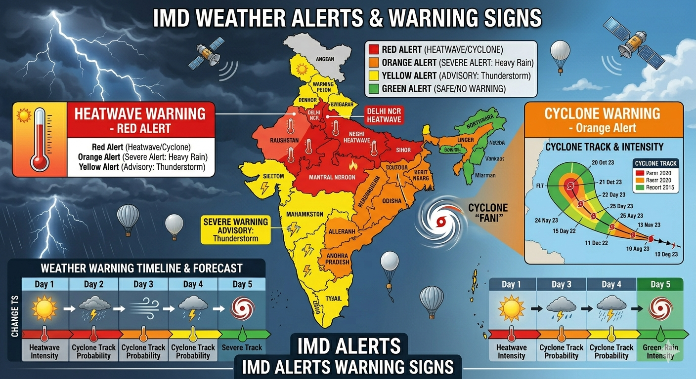
IMD issues colour-coded weather alerts: Red alert = extremely severe weather, take action immediately. Orange alert = severe weather, be prepared. Yellow alert = watch out, weather may worsen. States like Gujarat, Rajasthan, UP and Bihar often get heat wave alerts while states like Assam, Kerala and Karnataka get heavy rainfall alerts during monsoon season.
📝 Questions — Concept 10: Weather Predictions
Name any four ways in which weather predictions help people in daily life.
What are IMD colour-coded weather alerts? What does a Red alert mean? Who needs to act when a Red alert is issued?
In 2013, Cyclone Phailin approached Odisha’s coast. IMD predicted it accurately 4 days in advance. This allowed the government to evacuate nearly 10 lakh people before it hit. How does this example show that accurate weather prediction saves lives? What would have happened without the warning?
Today weather forecasts are available free on every mobile phone. But many farmers and fishermen in rural areas still do not use them effectively. What barriers might prevent them from accessing weather information, and what solutions would you suggest to bridge this gap?
📝 Chapter Quiz — 25 Questions
Test your understanding of all concepts in Chapter 2 — Understanding the Weather