
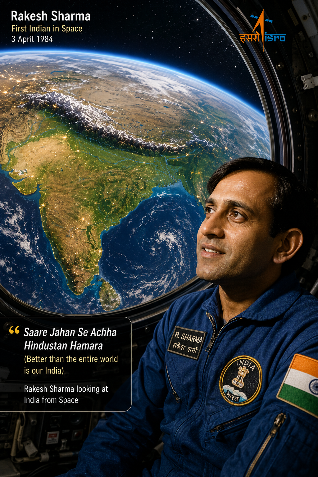
“When Rakesh Sharma, India’s first astronaut, was asked how India looks from space — he replied ‘Saare Jahan Se Achha’ — better than the whole world. What do you think makes India so special when seen from above?”
— Think about this as you read Chapter 1🎯 Learning Objectives — After this chapter you will be able to:
- Name the five major geographical regions of India
- Explain how the Himalayas were formed
- Describe India’s major rivers, plains, deserts, plateaus and coasts
- Explain how India’s geography affects the lives of its people
- Locate major physical features on India’s map
- Understand why India is called a ‘mini-continent’
India is the seventh-largest country in the world and is part of the continent of Asia. Along with its neighbours — Pakistan, Bangladesh, Nepal, Bhutan, Sri Lanka, and Myanmar — it forms the region known as the Indian Subcontinent. It is called a subcontinent because it is part of the larger continent of Asia.
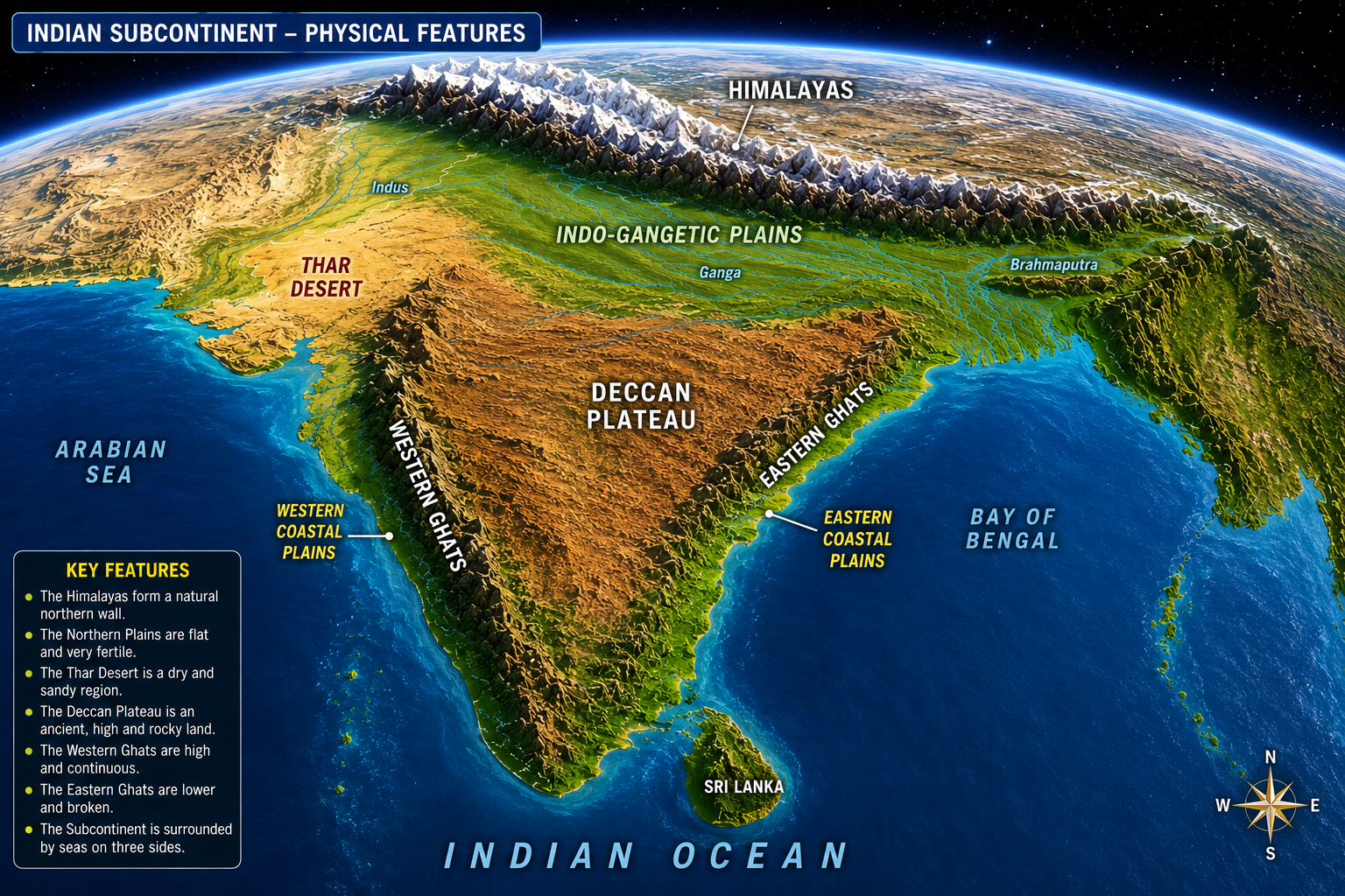
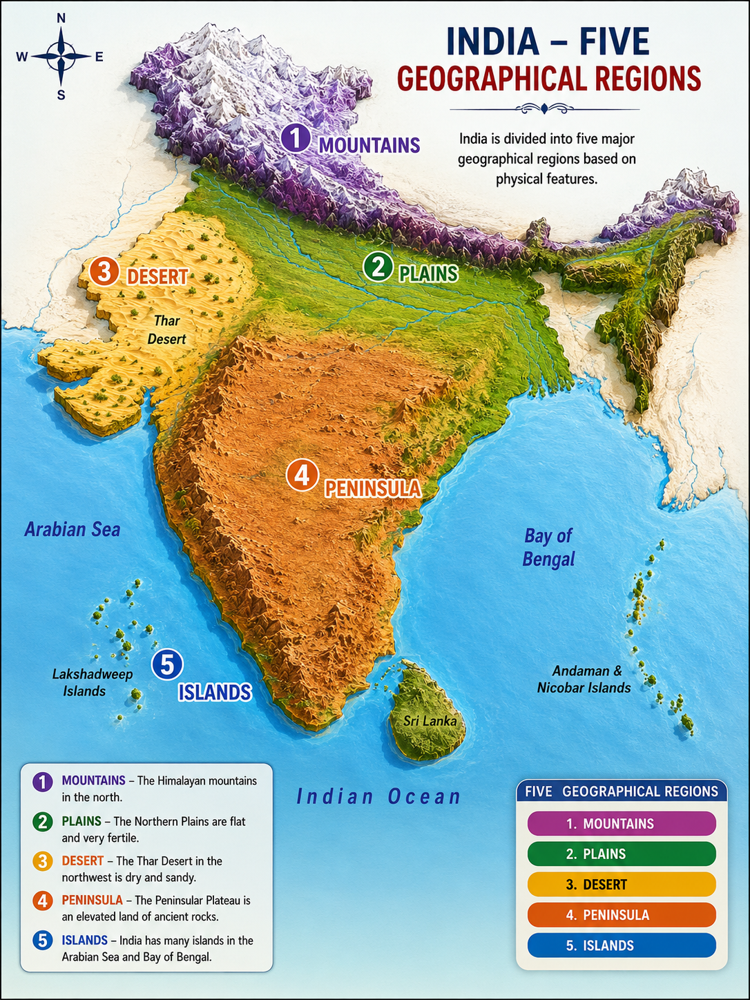
For the purpose of study, we divide India into five major geographical regions:
- The Great Mountain Zone — The Himalayas in the north
- The Plains of the Ganga and the Indus — Fertile northern plains
- The Desert Region — The Thar Desert in the west
- The Southern Peninsula — The Deccan Plateau
- The Islands — Andaman & Nicobar and Lakshadweep
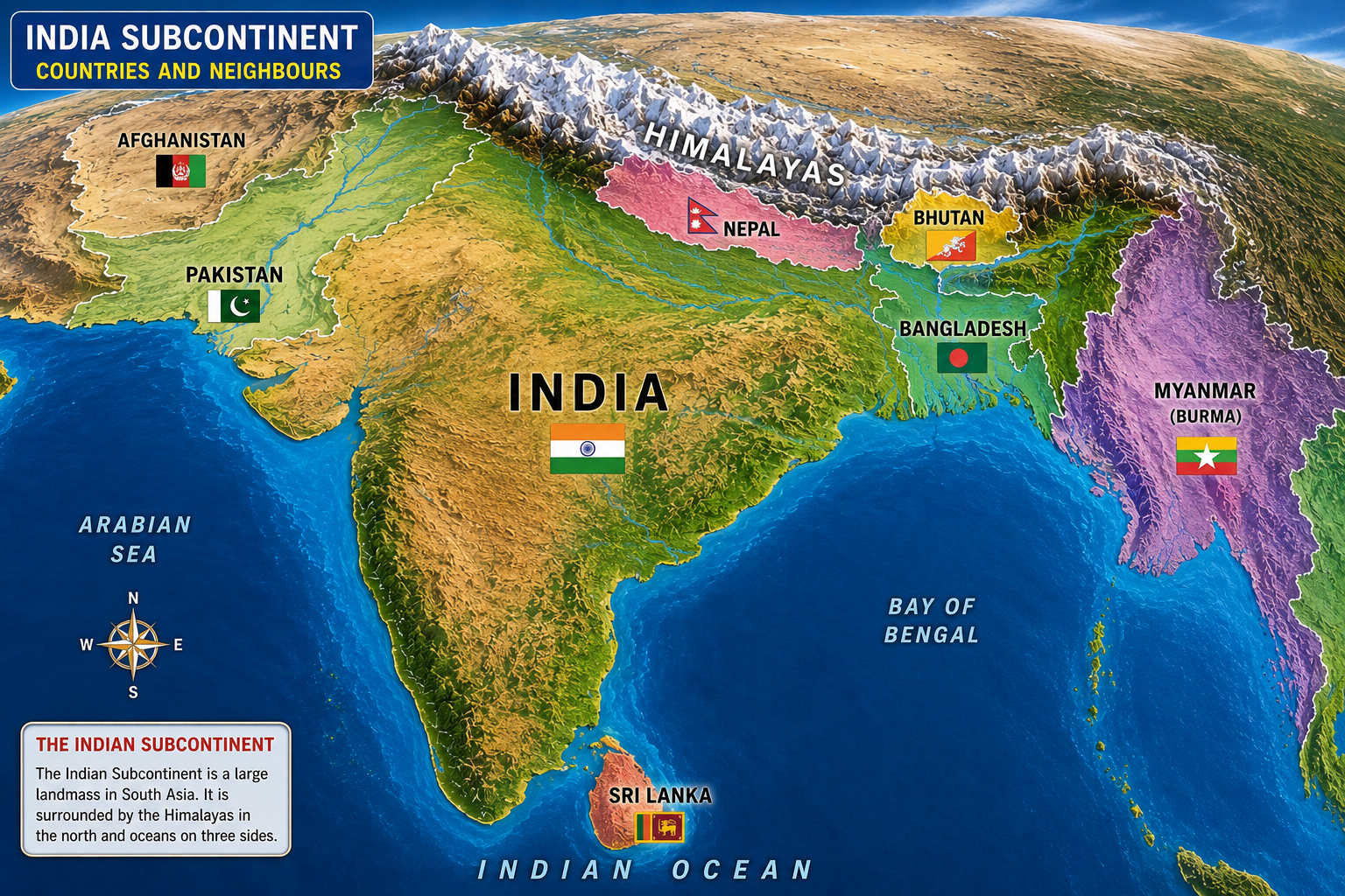
The Himalayan Mountain range stands as a natural barrier in the north. The Thar Desert and the Arabian Sea mark India’s western limits. To the south, the Indian Ocean and to the east, the Bay of Bengal form natural boundaries. These geographical features have played a crucial role in shaping India’s climate, culture and history.
Look at the map of India. Which landforms can you identify? What do the different colours on the map mean? Can you read, approximately, the latitude and longitude where India lies?
📝 Questions — Concept 1: Indian Subcontinent
Name the five major geographical regions of India as mentioned in the NCERT textbook.
Why is India called a ‘subcontinent’? Name any four neighbouring countries that form the Indian Subcontinent.
When Rakesh Sharma said “Saare Jahan Se Achha” looking at India from space, what geographical diversity do you think he was referring to? Explain with examples.
How have India’s natural boundaries — the Himalayas, the Arabian Sea, the Bay of Bengal and the Indian Ocean — shaped its history and culture? Give two examples.
Look at the Himalayan Range on the map — it is like a massive wall stretching about 2500 km in length. The Himalayas are the highest mountain range in the world.
The Himalayas seem to touch the sky. Many of its peaks are over 8000 metres in height and are together called the ‘Eight Thousanders’. This mountain range stretches across six countries in Asia: India, Nepal, Bhutan, China, Pakistan and Afghanistan. The highest mountain in the world is Mount Everest at 8,848 metres, located on the border of Nepal and China.
In summer, the snow on the mountains melts and feeds major rivers such as the Ganga, Indus and Brahmaputra. These rivers provide water for drinking, farming and industrial use, connecting with the lives of hundreds of millions of people. That is why the Himalayas are sometimes called the ‘Water Tower of Asia’.
The Himalayas are also important to many cultures and belief systems. The mountains themselves are considered sacred, and temples and monasteries have been built within them, attracting monks and spiritual seekers from around the world.
The word ‘Himalaya’ comes from two Sanskrit words — hima meaning ‘snow’ and alaya meaning ‘abode’ or ‘dwelling’ — thus, ‘Abode of Snow’.
📝 Questions — Concept 2: The Himalayas
What does the word ‘Himalaya’ mean? Name any two rivers that originate from the Himalayas.
Why are the Himalayas called the ‘Water Tower of Asia’? Explain with two points.
The Himalayas are important not just geographically but also culturally and spiritually. Explain this statement with examples from the chapter.
What do you think India might have looked like if the Himalayas did not exist? Write a short note mentioning at least three differences.
A long, long time ago, India was part of a much bigger landmass called ‘Gondwana’, where its neighbour was Africa! At some point, India broke away and slowly started moving north.
About 50 million years ago, it reached the landmass of Eurasia and collided with it. As India pushed against Eurasia, the land between them crumpled and rose up — just like how a carpet wrinkles when you push it. That is how the mighty Himalayan mountains were formed!
India is still pushing into Asia today, very slowly — about five centimetres each year. This means the Himalayas are still growing taller — about five millimetres per year. But over a millennium, that adds up to five metres!
📝 Questions — Concept 3: Formation of Himalayas
What was the name of the large landmass of which India was once a part?
Explain in your own words how the Himalayas were formed. Use the carpet analogy from the textbook in your answer.
The Himalayas are still growing taller at 5 mm per year. What does this tell us about the forces inside the Earth? Why is this important to know?
India was once a neighbour of Africa as part of Gondwana. How does knowing this change your understanding of how continents came to exist where they are today?
The Bhagirathi River, a major tributary of the Ganga, originates from Gaumukh (‘Cow’s Mouth’) in Uttarakhand. It is the edge of the Gangotri Glacier — one of the largest glaciers in the Indian Himalayas.
The Gangotri Glacier is considered sacred and attracts many pilgrims. Gaumukh is also a popular trekking destination. The next time you see the Ganga, remember — its journey began at Gaumukh high up in the Himalayas!
The Brahmaputra River is unusual — it gets bigger during summer instead of drying up! This is because it is mainly fed by melting snow from the Himalayas. The name Brahmaputra means ‘the son of Brahma’.
📝 Questions — Concept 4: Sacred Rivers
Where does the Bhagirathi River originate? What is the name of the glacier it comes from?
Why does the Brahmaputra River get bigger in summer instead of drying up? Explain the reason clearly.
Rivers like the Ganga are considered sacred in India. How does the geographical origin of the Ganga from the Gangotri Glacier connect to its spiritual importance for millions of Indians?
If glaciers in the Himalayas continue to melt due to climate change, what impact will this have on rivers like the Ganga and Brahmaputra and the people who depend on them?
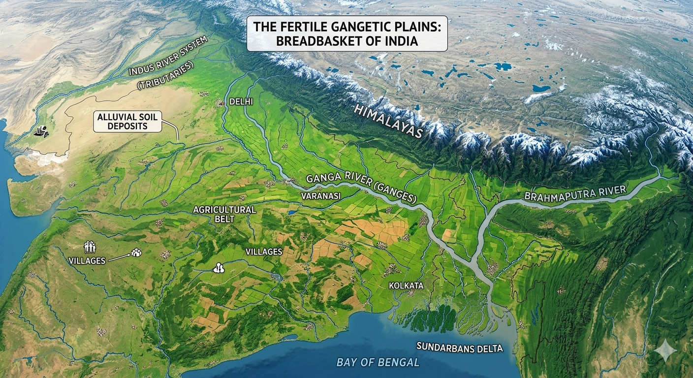
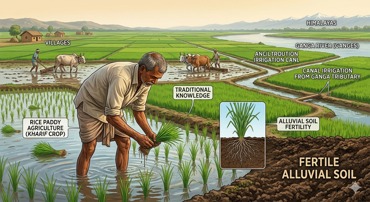
To the south of the Himalayas lie the vast Northern Plains, formed by the rivers Ganga, Indus and Brahmaputra. These plains are made of alluvial soil — soil deposited by rivers over thousands of years — making them extremely fertile.
The Northern Plains are among the most densely populated regions in the world. The fertile soil supports agriculture for hundreds of millions of people. Rice, wheat, sugarcane and pulses are the main crops grown here. The Ganga-Indus plains have been the heartland of Indian civilisation for thousands of years.
The Northern Plains stretch from Punjab in the west to Assam in the east. Most rivers are named after goddesses — Ganga, Yamuna, Kaveri — but Brahmaputra means ‘the son of Brahma’.
Follow one of India’s big rivers from where it starts to where it meets the ocean. What are the different ways in which people might utilise this river along its journey? Think about drinking water, irrigation, fishing, hydroelectric power, transportation and religious rituals.
📝 Questions — Concept 5: Northern Plains
What type of soil is found in the Northern Plains? Name two crops grown there.
Why are the Northern Plains considered so important for India’s agriculture? Give two reasons.
The Northern Plains have been the heartland of Indian civilisation for thousands of years. What geographical reasons explain why civilisations developed here and not in the Himalayas or the Thar Desert?
If the rivers Ganga and Indus dried up permanently, what would happen to the Northern Plains and the people living there? Explain with at least three points.
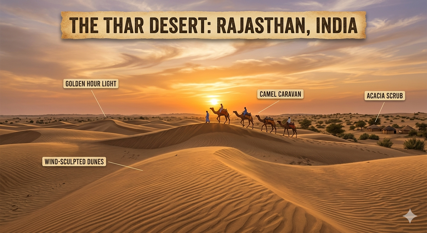
To the west of the Northern Plains lies the Thar Desert, also called the Great Indian Desert. It is located mainly in the state of Rajasthan. The Thar is one of the largest hot deserts in the world.
The desert receives very little rainfall — less than 25 cm per year. Temperatures are extreme — scorching hot during the day and very cold at night. Despite these harsh conditions, people have lived here for thousands of years, adapting cleverly to conserve water and survive.
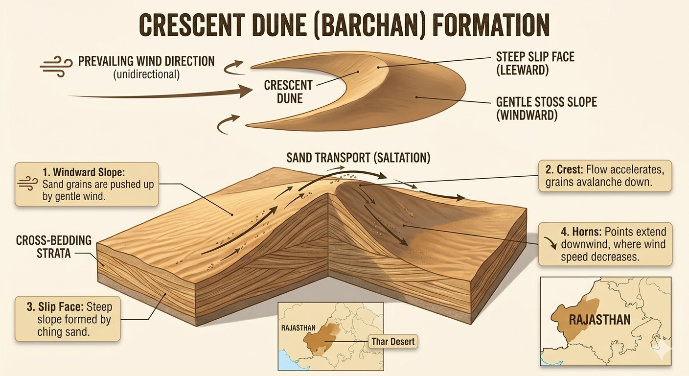
The shape of a sand dune is usually hill-like or crescent-shaped. Wind constantly moves and piles up the sand creating smooth sloping sides. Sand dunes change shape over time as winds reshape them — unlike mountains which have a fixed rocky shape.
Food preservation techniques differ across India. In Rajasthan, people dry vegetables when they are in season for use during the off-season — because water is scarce in the desert. This is one example of how geography shapes the way people live.
📝 Questions — Concept 6: Thar Desert
What is the other name for the Thar Desert? In which state is it mainly located?
How does the shape of a sand dune form? Why do sand dunes change shape over time unlike mountains?
People have lived in the Thar Desert for thousands of years despite extreme conditions. What adaptations in food, clothing, housing and water conservation do you think desert communities would have developed? Give at least three examples.
The Thar Desert receives less than 25 cm of rainfall per year. What would your daily life be like if you lived in the Thar Desert? How would it be different from your current life?
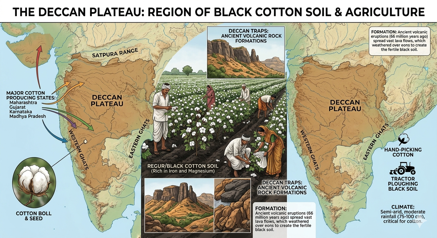
The southern part of India is called a Peninsular Plateau because it is a large elevated region surrounded by water on three sides — the Arabian Sea in the west, the Bay of Bengal in the east and the Indian Ocean in the south. It is bordered by the Western and Eastern Ghats.
The plateau is also called the Deccan Plateau. It is made of very ancient rocks — some of the oldest on Earth. The soil here is black soil, which is excellent for growing cotton. That is why this region is also called the Cotton Belt of India.
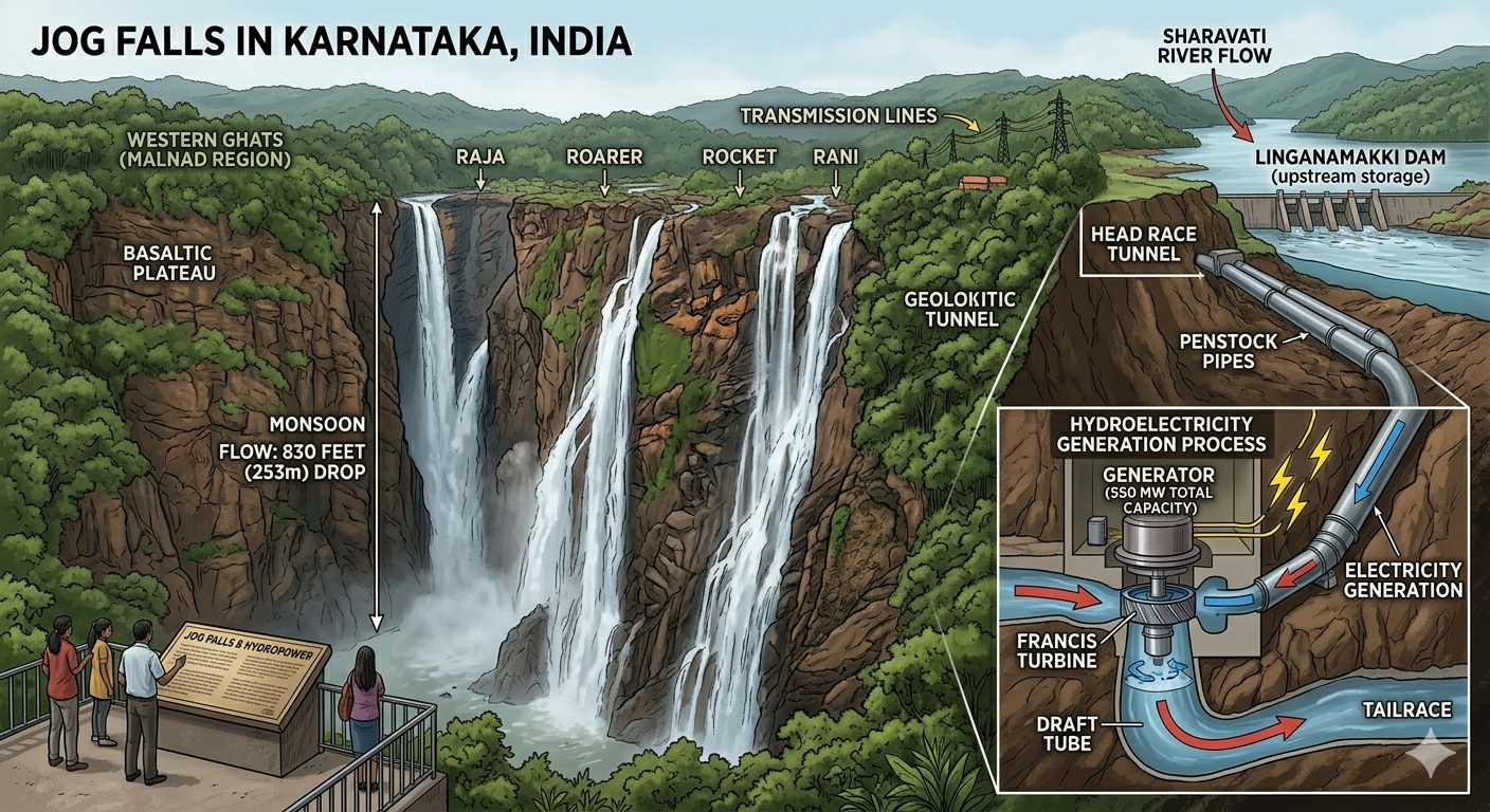
The Jog Falls in Karnataka is a spectacular waterfall on the Deccan Plateau. The power of the waterfall is converted into electricity (hydroelectricity) through special turbines — ‘hydro’ means water.
Why is the southern part of India referred to as a peninsular plateau? A peninsula is a piece of land surrounded by water on three sides. Can you name the three seas or oceans that surround the Deccan Plateau?
📝 Questions — Concept 7: Peninsular Plateau
Why is the southern part of India called a ‘peninsular plateau’? Name the three water bodies that surround it.
What is the Deccan Plateau known for in terms of soil and agriculture? Why is it called the Cotton Belt of India?
Jog Falls converts water power into electricity. What does this tell us about how geographical features can be used as natural resources? Give another example of a geographical feature used as a resource in India.
The Deccan Plateau is made of some of the oldest rocks on Earth. What does this tell us about the geological history of India compared to the Himalayas which are young fold mountains?
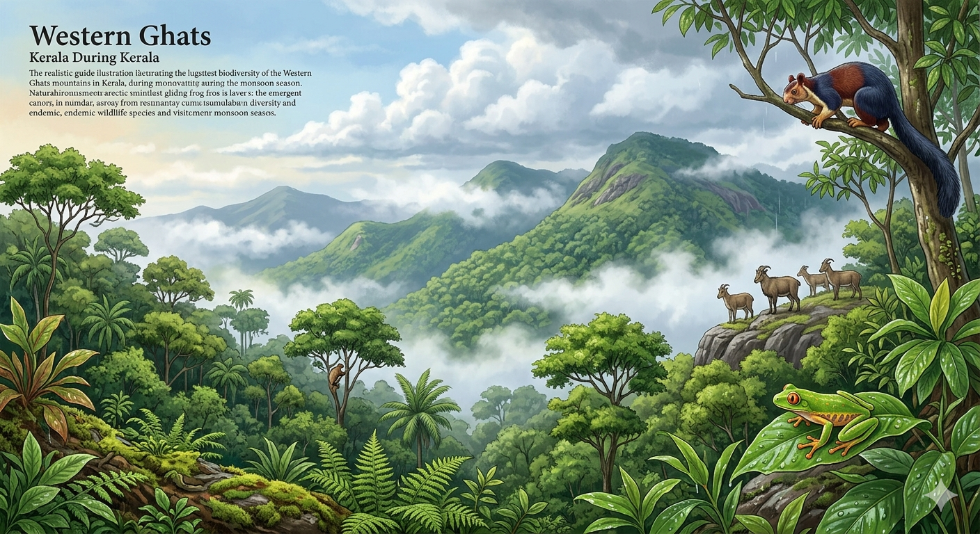
The Deccan Plateau is bordered on both sides by mountain ranges called Ghats. The Western Ghats run parallel to the western coast and receive heavy southwest monsoon rainfall, creating lush green forests and rich biodiversity. The Eastern Ghats run along the Bay of Bengal coast and receive less rainfall.
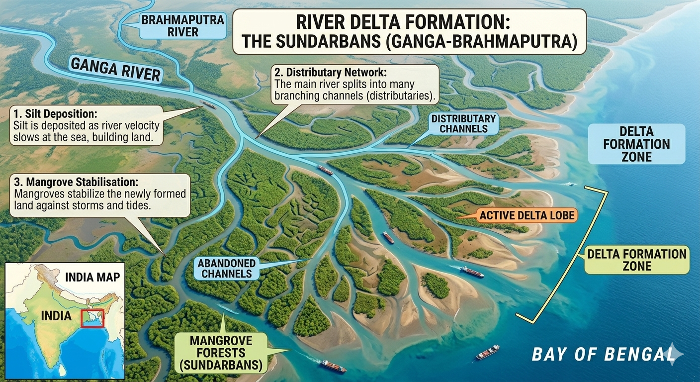
Between the Ghats and the sea lie the Coastal Plains. The western coastal plains are narrow with more estuaries, while the eastern coastal plains are wider and have large river deltas. Five rivers that flow into the Bay of Bengal are the Ganga, Brahmaputra, Mahanadi, Godavari and Krishna.
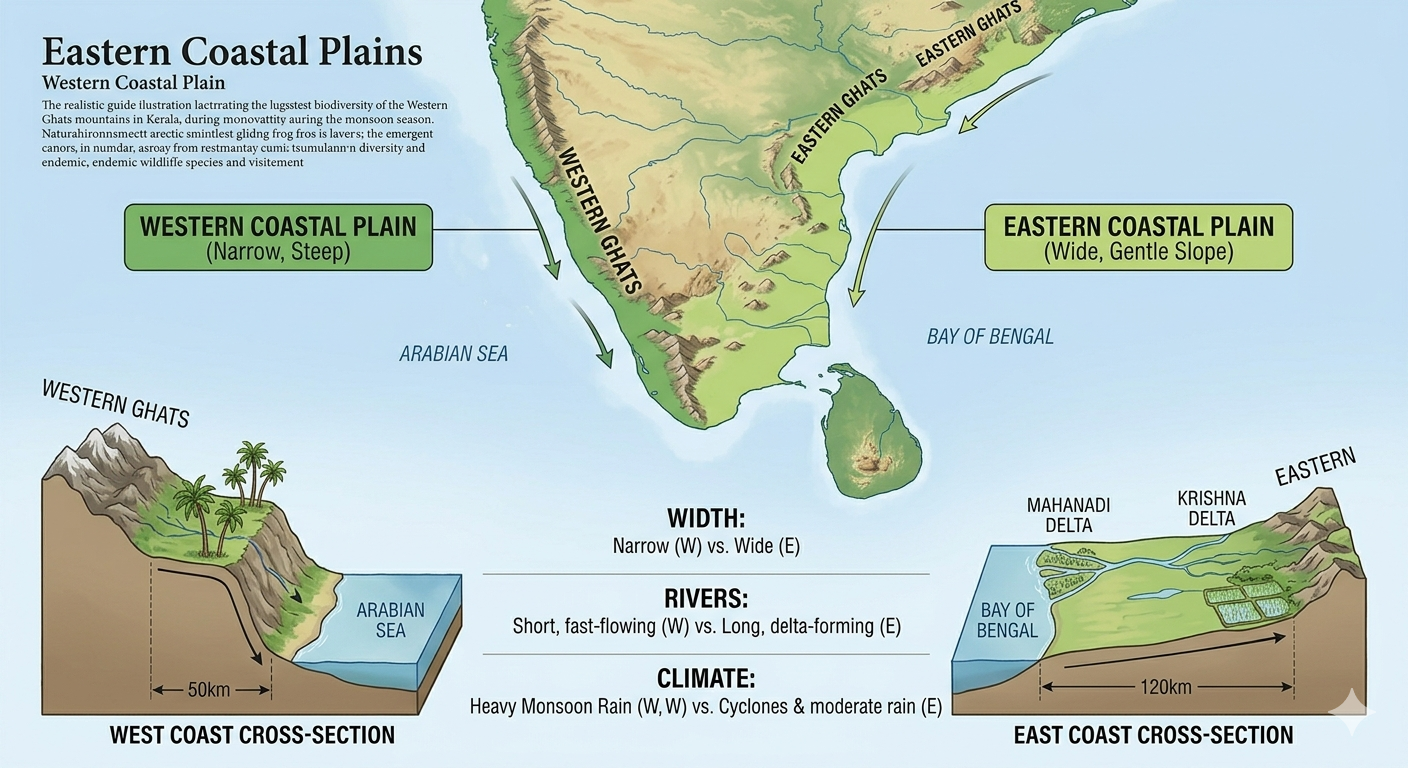
India’s coastal states include Gujarat, Maharashtra, Goa, Karnataka, Kerala, Tamil Nadu, Andhra Pradesh, Odisha and West Bengal. The western coastal plains are narrow because the Western Ghats run very close to the coast. The eastern coastal plains are wider because the Eastern Ghats are further from the sea.
When rivers split into multiple streams near the coast, it is called a delta. These streams are called distributaries and they spread out like branches of a tree as the river deposits sediments near its mouth before meeting the sea. The Ganga delta is one of the largest river deltas in the world.
📝 Questions — Concept 8: Ghats and Coastal Plains
What is a delta? What are the streams of a delta called? Name one major delta in India.
What is the difference between the western and eastern coastal plains of India? Give two differences.
The Western Ghats receive heavy rainfall while the Eastern Ghats receive less. How does this difference in rainfall affect the vegetation, rivers and lifestyle of people living on each side?
Coastal regions support fishing and trade. How does India’s long coastline of 7,500 km give it an advantage in terms of economy and international trade? Give two examples.
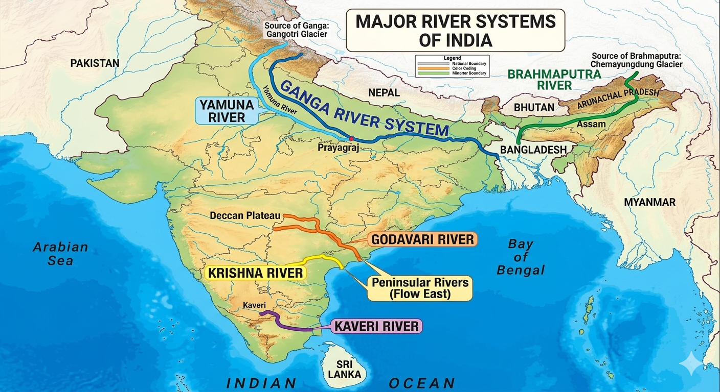
India has a vast network of rivers that are the lifelines of the country. Most rivers are named after goddesses — Ganga, Yamuna, Kaveri — reflecting their sacred importance to Indian culture. Rivers provide water for drinking, agriculture, industry, hydroelectric power and transportation.
Indian rivers are broadly classified into two types. Himalayan rivers like the Ganga, Indus and Brahmaputra are perennial — they flow throughout the year because they are fed by glacial meltwater and monsoon rains. Peninsular rivers like the Godavari, Krishna and Kaveri depend mainly on monsoon rainfall.
Five rivers that flow into the Bay of Bengal are the Ganga, Brahmaputra, Mahanadi, Godavari and Krishna. The Ganga originates from the Gangotri Glacier in the Himalayas and flows over 2,500 km to the Bay of Bengal.
📝 Questions — Concept 9: Rivers of India
Name any three rivers that flow into the Bay of Bengal. Where does the Ganga river originate?
What is the difference between Himalayan rivers and Peninsular rivers? Why are Himalayan rivers called perennial rivers?
Most Indian rivers are named after goddesses. What does this tell us about the relationship between Indian culture and its rivers? Why do you think rivers have been given such sacred importance?
India’s rivers connect mountains to the sea — passing through plains, cities and villages along the way. How do rivers act as a unifying force for India’s geography and people? Give three examples from the chapter.
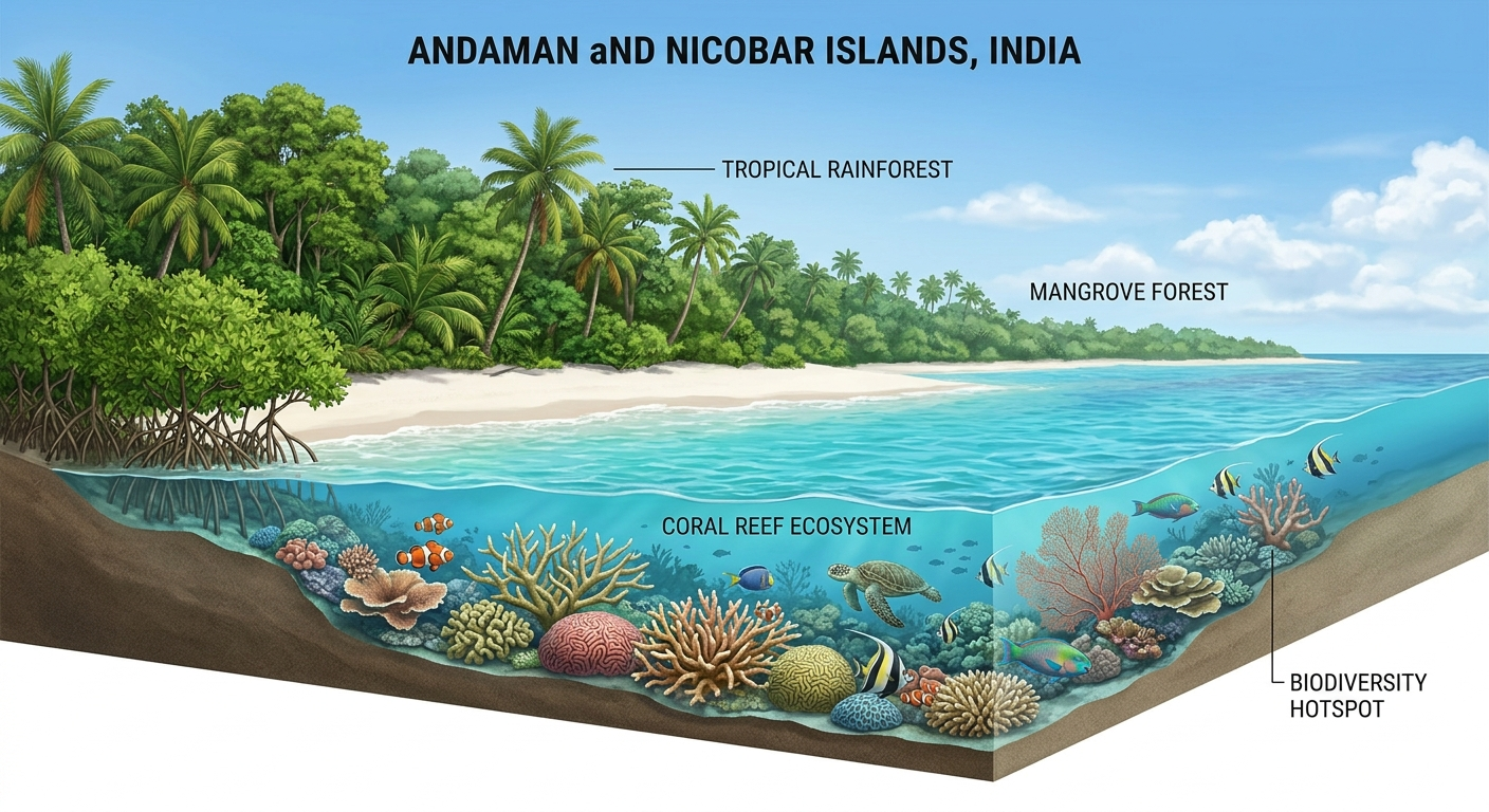
India has two important groups of islands. The Andaman and Nicobar Islands are located in the Bay of Bengal to the east of India. They consist of over 570 islands, islets and rocks. These islands are known for their dense tropical forests, beautiful beaches and rich marine life including coral reefs.
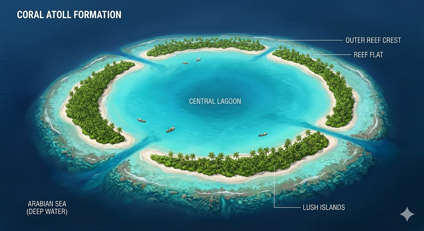
The Lakshadweep Islands are located in the Arabian Sea to the southwest of India. Lakshadweep means ‘a hundred thousand islands’ in Sanskrit. These are coral islands formed from coral reefs and are known for their turquoise waters, white sand beaches and unique marine ecosystems.
The Andaman and Nicobar Islands are in the Bay of Bengal — east of India. The Lakshadweep Islands are in the Arabian Sea — southwest of India. Together these island groups add significantly to India’s maritime territory and biodiversity.
📝 Questions — Concept 10: Islands of India
Name India’s two island groups. In which water bodies are they located?
What does ‘Lakshadweep’ mean? What type of islands are they and how are they formed?
Island ecosystems like Andaman and Lakshadweep are very fragile and can be easily damaged by human activities and climate change. What steps should be taken to protect these islands and their unique biodiversity?
India’s island territories give it a strategic advantage in the Indian Ocean. How do you think having islands in both the Bay of Bengal and the Arabian Sea benefits India in terms of trade, defence and maritime boundaries?
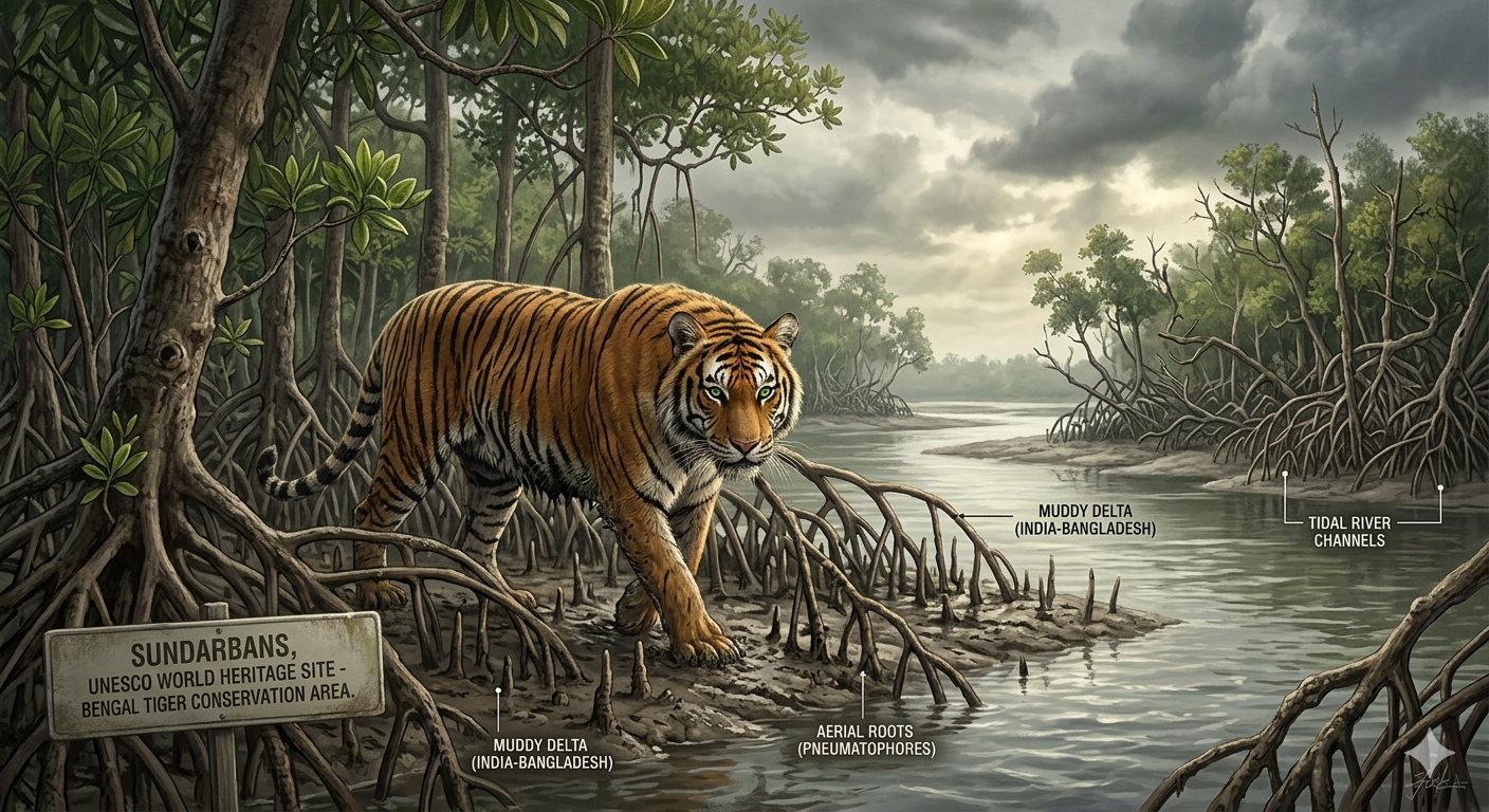
The Sundarbans is the world’s largest mangrove forest, located in the delta of the Ganga, Brahmaputra and Meghna rivers, shared between India and Bangladesh. It is a UNESCO World Heritage Site.
The Sundarbans is home to the famous Royal Bengal Tiger — one of the most endangered big cats in the world. The word ‘Sundarbans’ comes from the Sundari tree, the most common mangrove tree found here. The forest is a unique combination of rivers, sea and mangrove trees creating rich biodiversity.

The Sundarbans mangrove forests protect the coast from storms and flooding. Mangrove roots hold the soil firmly preventing coastal erosion. The Sundarbans is also important for the livelihoods of millions of people who depend on fishing and forest resources.
India has been called a ‘mini-continent’ because it has a huge variety of landforms, climates, soils, plants, animals and cultures — all within one country. You find mountains, deserts, plains, plateaus, rivers, coasts and islands — just like an entire continent!
Despite having such different regions — mountains, deserts, plains, coasts — India remains one country. How do you think India’s geography has helped unite its people? Think about how rivers, trade routes and shared resources connect different regions.
📝 Questions — Concept 11: Sundarbans
What is the Sundarbans? Which famous animal lives there? Why is it a UNESCO World Heritage Site?
How do mangrove forests protect the coast? Give two ways in which the Sundarbans benefits both nature and people.
The Sundarbans is shared between India and Bangladesh. What challenges might arise in protecting a natural heritage site that belongs to two different countries? How can they cooperate?
India is called a ‘mini-continent’ because of its geographical diversity. Based on everything you have learned in this chapter — from the Himalayas to the Sundarbans — explain why this name is truly deserved. Use at least five geographical features in your answer.
📝 Chapter Quiz — 25 Questions
Test your understanding of all concepts in Chapter 1 — Geographical Diversity of India